


Welcome to our suite of Geographic Information System (GIS) services, where we transform complex spatial data into powerful insights. GIS is a dynamic technology that creates, analyzes, and visualizes spatial data by linking location with descriptive information. Our solutions, which range from advanced mapping and spatial data analytics to web-based GIS solutions and field surveys (UAV & DGPS), enable better planning and decision-making through powerful enterprise integration. We also specialize in Smart GIS solutions, ensuring you have the right tools to gain a competitive edge in your industry.


Cailored geographic information systems built to meet your specific business equirements. From web-based mapping applications to enterprise-level GIS platforms, we deliver solutions that drive operational efficiency.

Seamlessly integrate disparate data sources and migrate existing GIS systems to modern platforms. Our experts ensure data integrity and system continuity throughout the process.

Scalable, secure cloud GIS infrastructure that grows with your business. Access your spatial data anywhere, anytime with our robust cloud-based platforms powered by industry-leading technologies.
Field-ready mobile GIS solutions that enable real-time data collection and analysis. Empower your field teams with intuitive mobile applications for enhanced productivity.
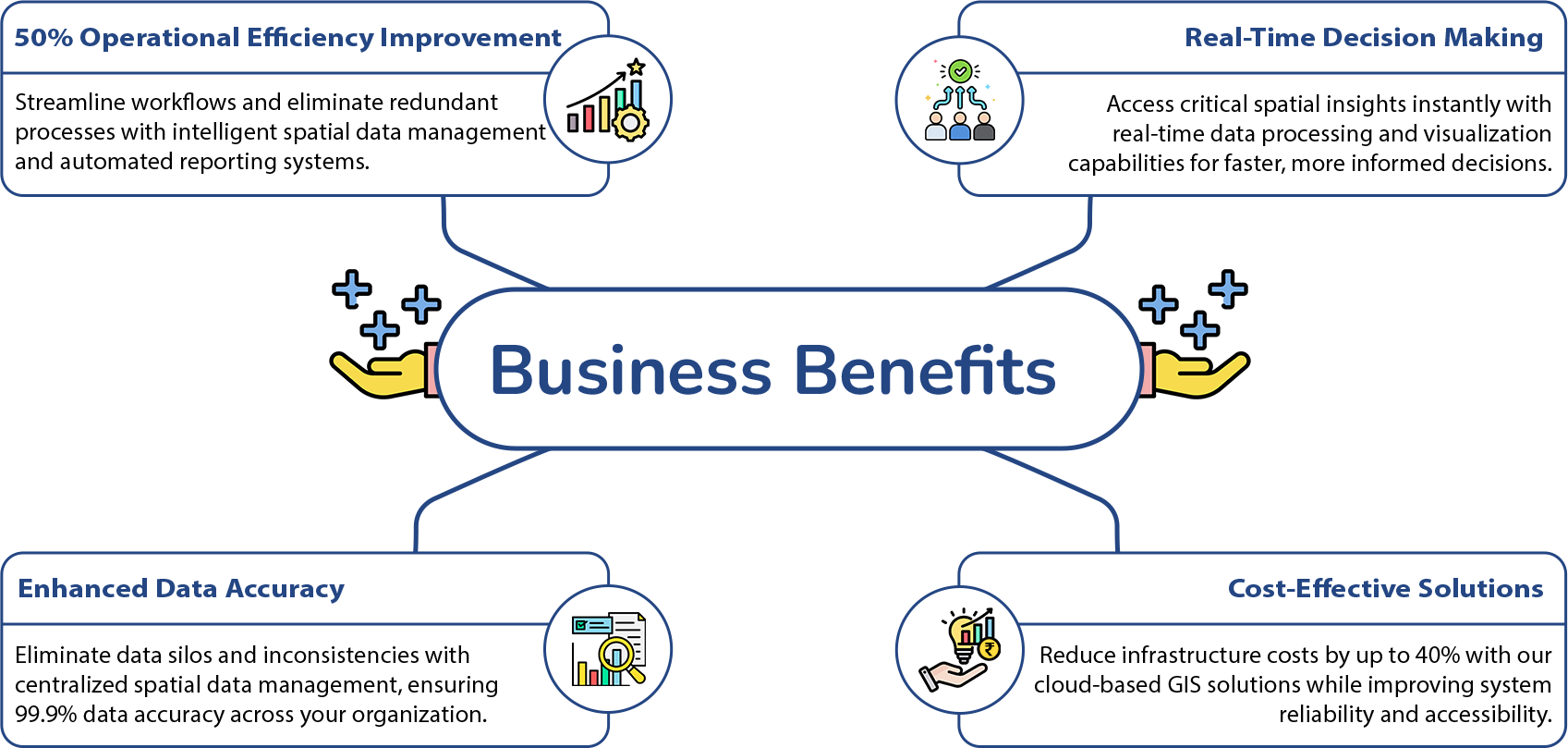
Advanced spatial analysis and data visualization services that transform raw geographic data into meaningful insights. Make data-driven decisions with our comprehensive analytics solutions.
Expert consulting services to optimize your GIS strategy and ongoing support to ensure maximum system performance. From planning to implementation and beyond.


Get your GIS solutions up and running quickly with our streamlined deployment process.


Bank-grade security protocols to protect your sensitive spatial data and ensure compliance.


Optimized systems delivering lightning-fast spatial queries and real-time data processing.


Fully customizable solutions tailored to your unique business processes and requirements.


Solutions that grow with your business, handling increasing data volumes and user loads.

Join the digital transformation journey with Oasys Tech Solutions. Let our decades of experience in IT consulting and innovative GIS solutions drive your success.
Contact Us